July 4, 2012.
Day: 41 Daily Miles: 46 Total Miles: 1812.25 Hours Hiking: 16 8:05am-11:50pm
Listen to the audio journal above or Download July 4th Audio File Here


Day 41
 |
| Mt. McLoughlin and the cinder coated trail. |
July 4, Day 41. Independence Day, yee haa... I made it 46 miles even
last night ending at mileage 1812.25. I stopped at the junction for
the Ranger Spring Trail about 20 miles away from the road in Crater
Lake National Park, so I'll be there tomorrow. Anyways, it was an
interesting day...actually I have a waypoint for my campsite... I
stopped at 0567880 E 4726203 N. Yesterday was an interesting day.
Basically, because I stayed up so late hiking the night before...or I
don't know..but for some reason I slept in. I didn't get up and leave
until about 8am. I was 4 miles short of where I really wanted to be
which was the shelter, but you know, things don't always go as
planned. I was slow to the get-go and was kind of dragging actually.
I've noticed that sometimes when I sleep in more than my normal, that
I can have a hard time in the morning. I made it to the shelter,
which was an easy stroll through the woods, flat, and then I came to
the cinders, or well the lava flows off Mt. McLoughlin that they've
really done a nice job with the trail, by making a level way through
the big bouldery fields of the lava. They've covered the trail with
dirt or with cinders to make a nice flat path. The trail is really
neat, really stark contrast with the dark grey-blue of the lava and
the red or brown dirt. It makes for nice photos. So a little ways
into that, I was just not feeling the energy. I had no go-power. I
stopped, had some sugar, some food...with the sugar, I figured my
lack of energy might be my blood sugar, and it seemed to be. I was
having a similar feeling as when I had giardia. I was a little
worried but it was definitely a blood sugar thing, once I kicked the
blood sugar up, I had energy again. So I decided to start listening
to a Science Friday podcast and like 5 minutes into that I look up a little
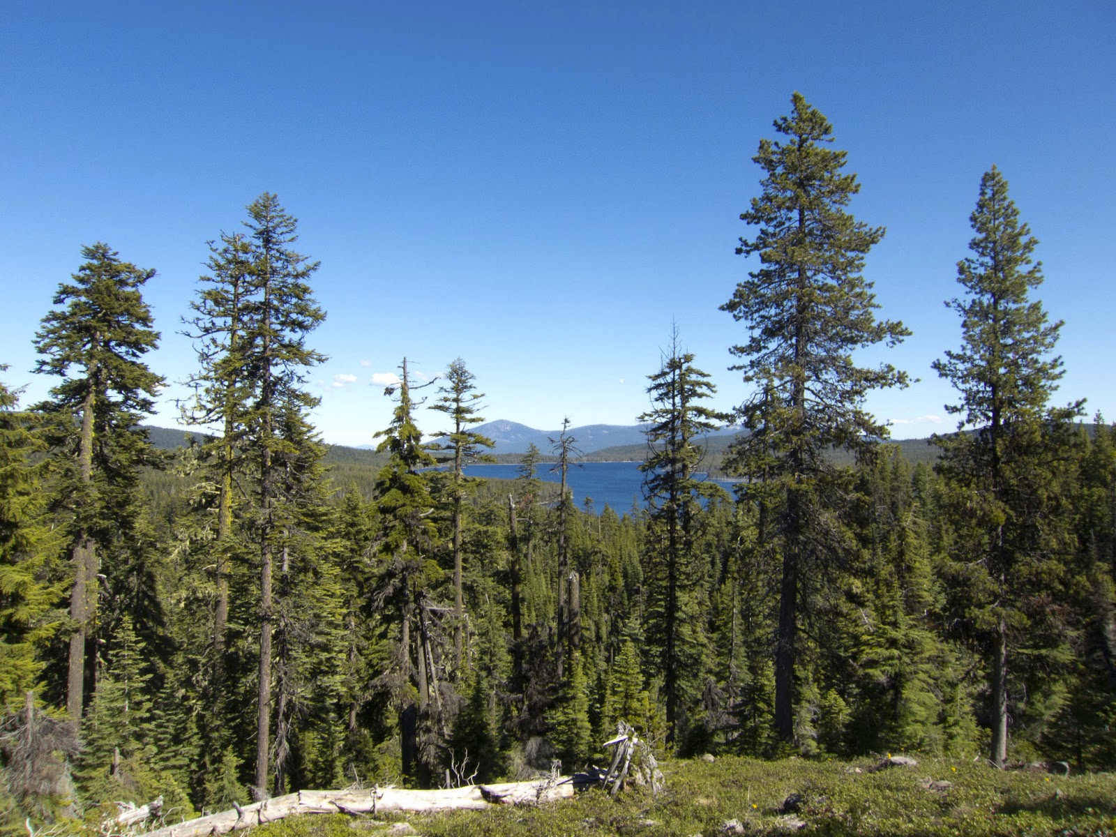 |
| One of the only views from the side of Mt. McLoughlin. |
hill ahead of me and see someone coming. I do my obligatory
shut off the music and pull out an earbud so I could talk to them or
hear them...and when the person gets close to me, I realize it's my
brother! *laughs* Which, was a complete and utter surprise, because
I'm still a good 6 miles away from any road or anything. But the way
it goes is that the day before I had talked to my parents and had
told them roughly where I was thinking about heading for the
night...they like to follow along, they had the map out and were like
'ohh where are you at??' And, I guess my brother was driving back
down to California from Washington and he had talked to my parents
and they were like 'oh, he's....Ryan will be..' they just did the
math of if I was at such and such a place, that he'll be crossing
highway 140 at roughly XX time. And so, he drove and parked at the
crossing at night...spent the night at the trail head and in the
morning about 9am or something like that, he just started hiking
backwards to meet me. If I had known, I probably would have had a
little bit more energy, but I started late, I was short of my
estimated destination, so he had to walk a hell of a lot further than
I think he ever anticipated, but he was all about it, not a big deal
{gave him a taste of what I've been doing for the last 40 days!}. So
I had a good 1.5 hour chat with him all the way back until Highway
140, where he had a little bit of food. It was cool. It was really
one of those unexpected things that make your day better. There was a
little trail magic a little ways in, so I had a soda and I actually
saved it for later. He left, shoot probably..I don't know...I
probably spent an extra hour with him, so I was even more behind. But
sometimes it just doesn't matter. I then stated up the Mt. Mcloughlin
trail and it's a fairly slow climb up and around the mountain through
the trees. A good like 17 miles of just tree walking, it's pretty
boring because you don't have any views except for at one point you
see a lake. Then, finally, you get up to the long ridge that leads to
Devils Peak, and once there, you get some views because you're up high. However,
 |
| A not so fun snow field crossing. |
the snow had started before that in patches. Up until
about mile 1803, I had crossed about 50 snow patches {I was
counting!}, which weren't difficult at all and didn't really slow you
down, but they were across the trail and you couldn't avoid them.
Once you hit 1803, you're on the ridge where the Divide Trail splits
off and the PCT takes a westward turn, so you have to cross the north
face/the back side of a mountain. Basically, there's where it starts
getting 'fun'. That's where I started losing count on how many snow
drifts I had crossed because it got serious. That crossing wasn't soo
bad, as a couple people had been across it before me, so there were
footprints and the snow was soft on account of me being there at the
end of the day, around 8pm. So nothing too bad at all, but when I got
up and over to... Well prior to this I had had the soda, so I was
feeling good. I knew I needed to get over Devils Peak before it was
totally dark, because if I had to wait until the morning, it would
probably be very icy or at least have time to harden up. So that was
a big thing, since I knew there was going to be a large snowfield...
Following the ridge it turned from these snow patches to some more
snow patches to a snow field then you're up on another ridge that was
minimal snow here and there. Thankfully, we went around the west side
of one of the little peaks you go by, and that was a little more
difficult, as there were tall snow drifts on trails on an uphill, so
you had to climb up the big face and then kind of flat walk to the
trail. But, the hard part was when you come to a little saddle and
switchbacked to the east side, where there was a cornice and a HUGE
snowfield, with not what I would consider serious consequences if you
fell, but a steep down for about 100-150 feet....so you didn't want
to fall. The trail poked out in only a couple places along this big
face, but thankfully the snow was really slushy for having been on an
east face and had had the whole day to warm up. Kicking steps was just a matter of stepping
down hard and making a big hole - not quite
postholing, so it was pretty nice. That being said, it wasn't that
difficult, but it did slow me down. Once I got back into the trees,
the drifts started up intermittently again all the way until about
the last 1/4 mile before Devils Peak which wasn't snow covered. At
the point where the switchback turns and starts heading down, there's
this most amazing tiny little cowboy campsite on this point next to a
tree that overlooks all of the ridge that you have just come up. I
actually met Billy Goat there in 2009, he was hunkered down for the
night, when I met him there in the evening.... When I came around
that little corner and looked down, it was just a solid steep snow
field, which I was expecting, that's why I was pushing so hard. I had
arrived there a little ahead of what I had estimated, right around
9:40pm or so. So it was dark, but the more or less full moon was up,
so it wasn't super dark. I had already taken my flashlight out and
was holding it in my teeth just so I could see better {while
navigating the snow patches with my trekking poles}. You know, the
only way down from this point is to just go down. There really was
no...easy way down. It looked like other people had glisaded...I
walked down to a little less steep portion and turned my feet
sideways and started sliding down with my feet perpendicular to the
down direction and trailed my trekking pole behind me, to kind of
arrest myself a little bit. About 1/4 of the way down it turned icy
and I couldn't really stop or check my speed so I had to dig my
fingers and knee into the snow and skidded to about half way down the
slope where it changed slope again and was a little less steep and
got back slushy. So, I stood back up and shoe skied the rest of the
way down. In all it cut, well it didn't really cut, but i bypassed
the switchbacks which equated to about 1/2 a mile worth of trail, yet
it still took a good long ways to get out of the snow. The first
little bit was done. I had to walk through some trees and I was still
on the side of a really steep bowl, I found another snow slope, skied
down that, walked over and down some more, skied down that. If I
hadn't had the GPS, I would have been totally lost. There was just
snow covering everything, you
were in the trees and you would not be
able to find the trail in the dark. That was fun. Actually it was
some of the.... It's the only fun I can remember having so far on
this trail. It was one of those...a little bit of an adrenaline rush
and something totally different from what I have done so far, and
kind of adventurous. So, once I plodded down through the snow and had
to track down the trail, I proceeded to have to hop up and over all
the rest of the snow banks. I mean there was snow all the way down to
the 5000 foot elevations just hanging out in the trees, so that means
the rest of Oregon is going to have a ton as well. The little
adrenaline kept me going. I just kept plodding on. I didn't feel
super tired when I finally hit camp at about 11:40pm, but when you
sit down you're like " OHHH I'm so glad I'm sitting down!' I
made dinner, took care of most of my things, but didn't do my foot
maintenance. I left that for the morning and went to sleep somewhere
after 12am. So it was a late night, but I got the miles done and
basically having woken up late and having an extra hour of off I feel
like I did OK, especially considering all of the snow.
In addition to July 4, I forgot that I
had actually postholed and kind of hyper extended my right knee. It's
the knee that I've felt little twinges of pain in for a good little
while now. When I sit cross-legged at night, I can't really move that
leg on it's own without feeling this sharp lighting bolt pain shoot
down out of my knee. So usually I just pick it up and move it to a
position where I can move it again more easily. It's just made it
hurt more. So, I'm going to have to keep an eye on that. You know, I
don't really want to do any permanent damage, more-so than I already
have I guess. I've got to get 20 miles or so to Crater Lake and get a
resupply. I'm pretty sure I'll eat at the buffet, then have a fun
climb and then get a beautiful view, then I get to drop down. So, it
should be a pretty good day once I get to Crater Lake. Currently I'm
walking though this big burn area that I don't remember. It's kind of
sad. I've still got about 15 miles to go...so away a ways, a ways.
 |
| Sunset from around mile 1800. |